Ride Kentucky’s Route 32: Morehead to Louisa
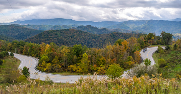
Experience the breathtaking Appalachian Mountains from the seat of your bike on Kentucky Route 32 (SR32). The mostly rural road runs east-west through northeastern Kentucky. The western terminus is in Georgetown, at a juncture with U.S. Route 62 (US62). The eastern terminus is in Louisa, at a juncture with SR3. While the full length of SR32 is just shy of 162 miles, the most appealing section for motorcyclists is the nearly 80-mile stretch from Morehead to Louisa. On SR32, you can weave your way through the rural fields and forests of the mountainous Kentucky terrain.
Route 32 route map: Morehead to Louisa
Our map focuses on the section of SR32 between Morehead and Louisa.
Weather conditions for your Route 32 ride
Weather in northeastern Kentucky is relatively mild all year, but evening temps can drop below freezing in the winter and spring, so plan accordingly. Changes in weather can affect rural, mountain roads, so always make sure to check the forecast. Review the monthly averages for Grayson, Kentucky, to help you plan your trip to the Appalachians.
Route 32 motorcycle riding safety tips
This is a wonderful rural route with almost no crossroads—but every road has its share of hazards. Here are some safety tips to keep in mind as you ride:
Loose gravel can reduce traction, so keep your eyes on the road ahead and slow down if you see any coming up.
Keep an eye out for tractors and other farm equipment. Give these large vehicles plenty of space and watch for debris.
Take a leisurely pace on this road. Enter curves at a moderate speed as some can surprise you.
Watch out for domestic animals and wildlife in the farmlands and forests.
If you want to spend some time enjoying the scenery, find a safe spot to pull over first. When you're riding this curvy road, keep your focus where it should be: on the road ahead of you.
Take a motorcycle ride on Kentucky State Route 173
For a motorcycle rider like you, the biggest attraction of SR32 is probably its lack of commercial attractions. For an added thrill on your ride, consider adding an extra loop on your way back from Louisa to Morehead.
On your way back to Morehead, 19 miles west of Newfoundland, turn left onto State Route 173 (SR173). SR173 is a 10.6-mile roller coaster along a mostly wooded ridgeline. It will bring you to a stop sign at a T-intersection with SR7. Make a left turn heading north. In just over five miles, you’ll arrive at another T-intersection with a stop sign. Make the left onto SR32/SR7 and resume your ride back to Morehead.
La información general contenida en este blog tiene únicamente fines informativos o de entretenimiento. Vea el descargo de responsabilidad de nuestro blog.
*La exactitud de los datos está sujeta a la fecha de publicación de este artículo.


