The Beartooth Highway: A motorcycle route guide
0 min. read
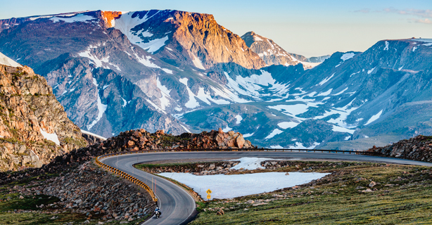
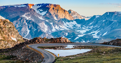
Beartooth Highway is a challenging, one-of-a-kind motorcycle route that runs along the Montana-Wyoming border. It was rightfully dubbed “the most beautiful road in America” by Charles Kuralt—legendary creator of the “On the Road” segment of The Evening News with Walter Cronkite.
Motorcycle enthusiasts can't get enough of the spectacular mountains and glacial lake views, forested valleys, and seasonal waterfalls. With minimal traffic and great curves, this highway lives up to the hype.
Beartooth Highway precautions and safety tips
The Beartooth Highway isn't your average motorcycle route. Even in summer, temperatures above the tree line can be frigid. You can expect as much as a 15- to 20-degree temperature difference between the base and the summit.
Dress in layers and pack cold-weather riding gear
Check your tires for tread-wear and replace them if necessary
Review winter riding safety tips
Closely monitor road conditions as temperatures fluctuate
Familiarize yourself with the route—Beartooth features hairpin turns, steep drop-offs, and narrow roadways
Keep tabs on other motorists—sightlines around curves may be limited and some drivers might take the road slower than others
Consider adding roadside assistance to your motorcycle coverage. If you break down or run out of gas on the Beartooth Highway, this coverage can help pay for emergency services
If you're a new rider, we recommend you gain some experience before choosing this route—or at least plan to take your time. While there are guardrails along the most extreme sections, Beartooth may not be the best route if you're uncomfortable navigating these types of conditions.
Weather along Beartooth Highway
If you're not used to riding in the Rockies, you may be surprised that summer arrives relatively late—especially when you hit higher elevations.
When planning your trip, know that the Beartooth Highway is only open from May to October. However, snowpack can cause delays. It’s not uncommon for visitors to ride alongside 15+ foot snowbanks around Memorial Day. June’s often unpredictable snowstorms can still shut down the highway. If you enjoy warmer temperatures, your best bets are July, August, and early September.
Always check the Montana Department of Transportation's site before you start your trip. You can use the chart below of Absaroka-Beartooth Wilderness monthly climate averages from May to October to help plan your ride along the Beartooth Highway.
Beartooth Highway route map
As you can see, Beartooth Highway is a unique route that requires some planning—but it's worth every effort. This dramatic, scenic drive passes through alpine forests and offers frequent lake views. There are several scenic places to stop, so it’s best to have a plan and build in plenty of time for exploring.
Also note, while there are plenty of pull-offs and lookout points, gas stations and bathrooms are harder to find. Make sure you have a full tank before you leave Red Lodge, Silver Gate, or Cooke City.
Check out our route map to start your planning, keeping weather conditions and safety precautions in mind.

Stops to make along Beartooth Highway
If you drive the highway straight through with zero stops, you should plan a little under two hours to ride from one end to the other. But to get the most out of the trip, you’ll want to stop at notable points of interest to take in the spectacular scenery.
Clay Butte Lookout and the Summit
Forest Road 142 is a three-mile dirt road that leads to an old fire lookout tower that serves as the current visitor center. Here, you'll take in panoramic views of the mountains and Yellowstone National Park.
If you ride 11 miles west down the Beartooth Highway, you will reach the Beartooth Summit Vista. Here, the Summit of Beartooth sign is the perfect photo-worthy stop, but you need to hike down a short dirt road to enjoy the views. The parking lot overlooks the Wyoming switchbacks.
Cooke City and Silver Gate, MT
If you want to explore small mountain towns offering food, gas, and lodging, there are two gateway communities outside the Yellowstone National Park Northeast entrance. These tiny outposts are charming and full of unique experiences, like the Cooke City Store, first built in 1886. This historic general store now stocks books, dry goods, groceries, and maps.
Popular hubs for outdoor adventures, these towns are the perfect home base for those who want to fly fish, horseback ride, or hike before or after their motorcycle rides.
If you’re a foodie, don't miss Beartooth Café—open Memorial Day thru September—to enjoy burgers and steak in the 1936 log-building dining room. For breakfast or lunch, the Bearclaw Bakery is the spot for specialty coffees, homemade soups, a full breakfast menu, and other from-scratch goods.
Red Lodge, MT
Red Lodge is a larger yet equally quaint town at the opposite end of the Beartooth Highway. It's a popular Beartooth base camp with many options for lodging and food.
Red Lodge is also home to Montana's largest motorcycle rally, the Beartooth Rally. Each summer (usually mid-July) for the last 30 years, thousands of bikers gather to participate in special events, ride the Beartooth Highway, and enjoy motorcycle culture. It’s a great time to take a ride.
Top of the World Store
The Top of the World Store sits at 9,400 feet in elevation. This photo-worthy spot is the only place between Cooke City and Red Lodge to get gas, food (primarily grab-and-go snacks), lodging, or gifts. It’s conveniently located just off the highway, about halfway between the two cities.
The general information in this blog is for informational or entertainment purposes only. View our blog disclaimer.
*Data accuracy is subject to this article's publication date.


